
Your browser is not supported
The browser you are using - Internet Explorer or old version of Edge – is not supported by our website. Not to face issues while using our website please use the latest version of Edge or any other modern browser like Chrome, Safari or Firefox.
Our best offers in La Palma !
Your holiday in La Palma
Contrasting landscapes and fascinating volcanic islands
The Canary Islands have so much to offer, from subtropical landscapes and lush vegetation to desert landscapes to breathtaking cliffs and golden beaches. There’s Lanzarote, the land of lava and fire, Fuerteventura with its endless beaches, La Palma with its unspoilt nature, Tenerife with its imposing volcano, and Gran Canaria with its majestic dunes reminiscent of the Sahara desert... Each island is different, but they are all bathed by a generous sun and enjoy a mild climate, so you can be sure of a great beach holiday all year round!
A verdant landscape with captivating scenery
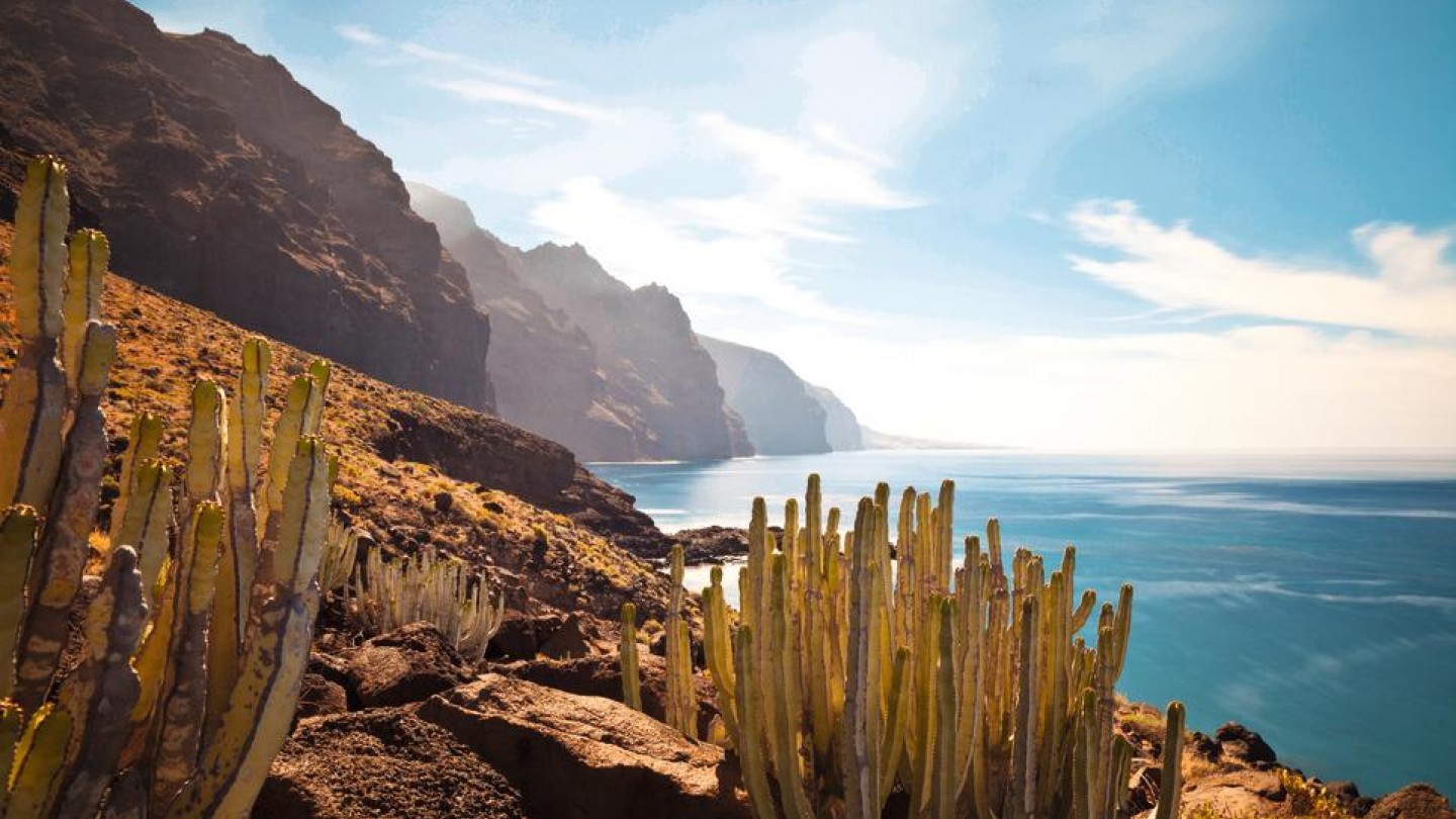
La Palma, also known as "La Isla Bonita", is the most north-westerly island in the Canary archipelago. Its breathtaking scenery of age-old forests, multi-coloured waterfalls, natural pools and black sand beaches are an idyllic setting for recharging your batteries in a natural and authentic atmosphere. The impressive Caldera de Taburiente crater, at the centre of the island, dominates the landscape. Meanwhile, at the top of the 2,420 metre tall Roque de Los Muchachos, you'll find one of the most important astrophysical observatories in the world. La Palma provides perfect conditions for stargazing thanks to its proximity to the equator and the purity of its atmosphere. As well as being a feast for the eyes, the island also boasts a rich culinary tradition featuring seafood specialities and excellent cheeses, as well as excellent craft beers and local varieties of wine.
Tourist areas
28.682008869332, -17.774000204014
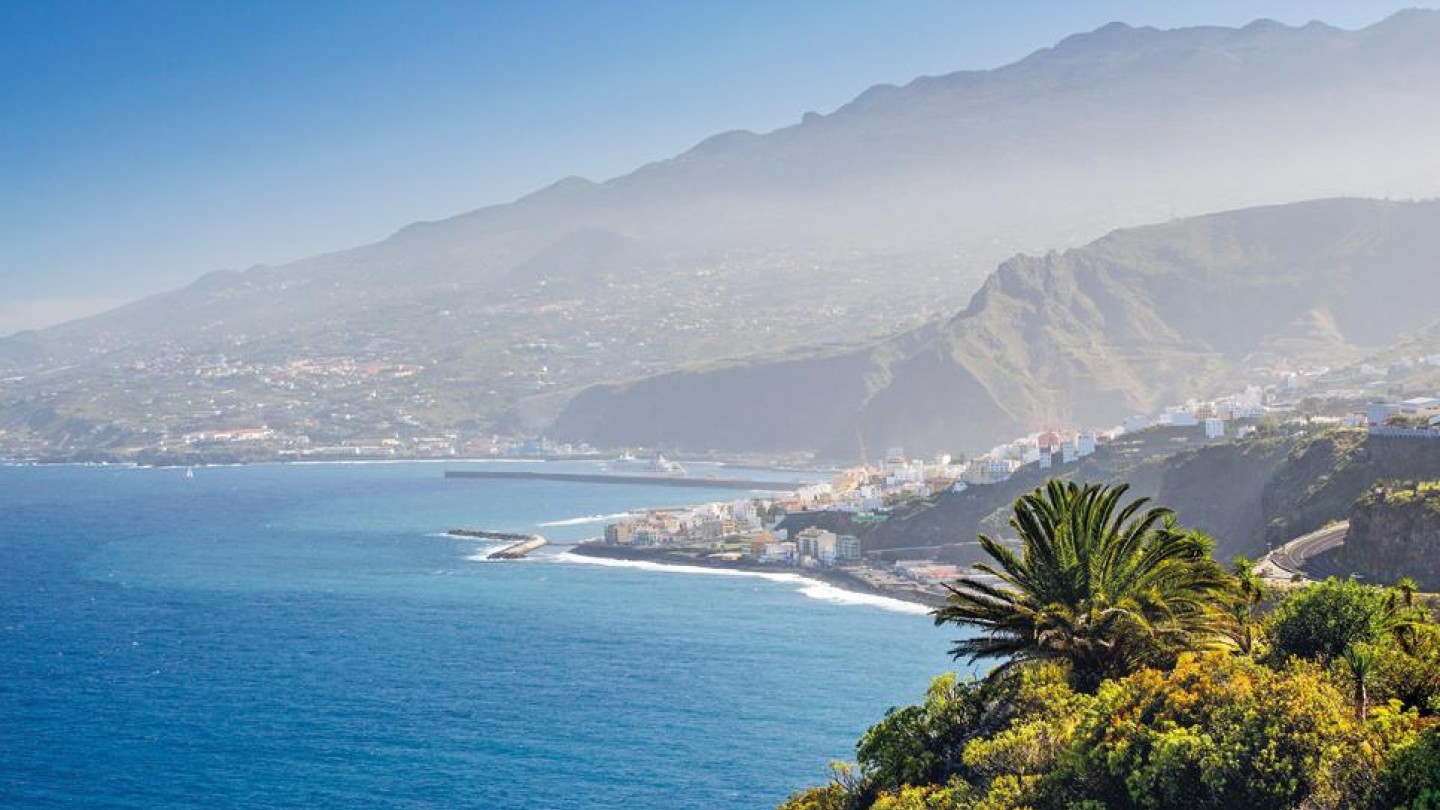
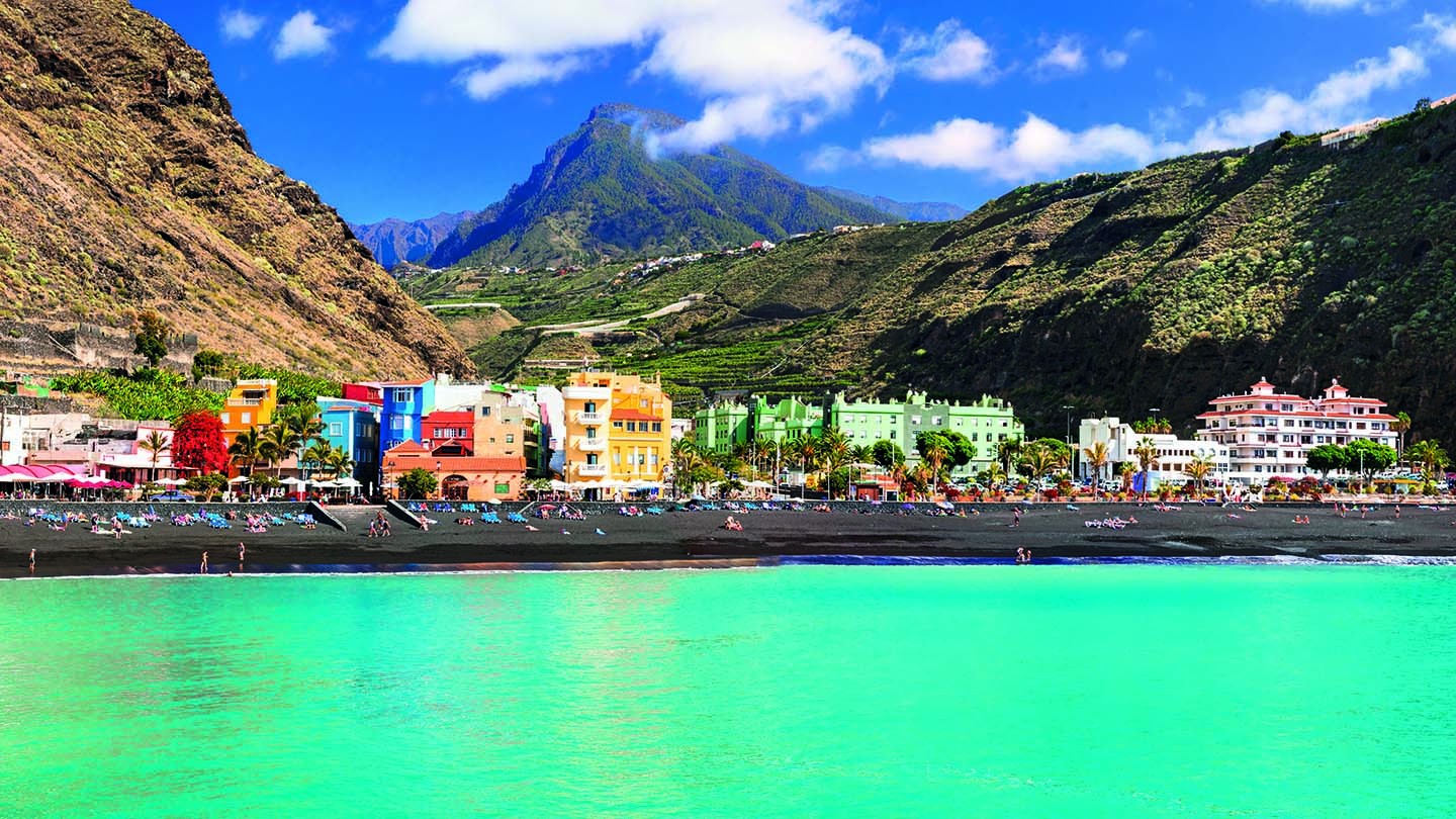
Los Cancajos
The seaside resort of Los Cancajos is bordered by a black sandy beach and lies on the east coast between the capital, Santa Cruz, and La Palma airport. This former fishing village is flanked by a seafront promenade perfect for long strolls, and its small town centre, with cafés, restaurants and boutiques, is well worth a visit for a lunch break or a shopping spree. The town is known for its salt mines, which are the oldest salt mines in La Palma. Distance from the airport: 2 km.
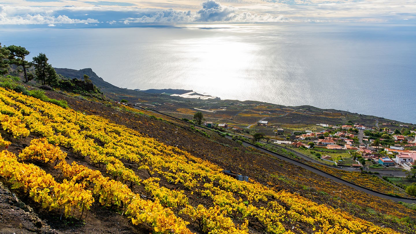
Fuencaliente
Fuencaliente is a town on the southern tip of La Palma. It is known for its palm wine and the grape harvest is celebrated here in a traditional fashion. The vines grow on sunny volcanic slopes and are criss-crossed by winding country roads which run down the side of the region's three volcanoes towards the coast. If you enjoy hiking, Fuencaliente is the ideal starting point for exploring the island's volcanic landscape on foot. When the sky is clear, it is even possible to see Tenerife, La Gomera and El Hierro from the San Antonio volcano. Distance from the airport: 25 km.
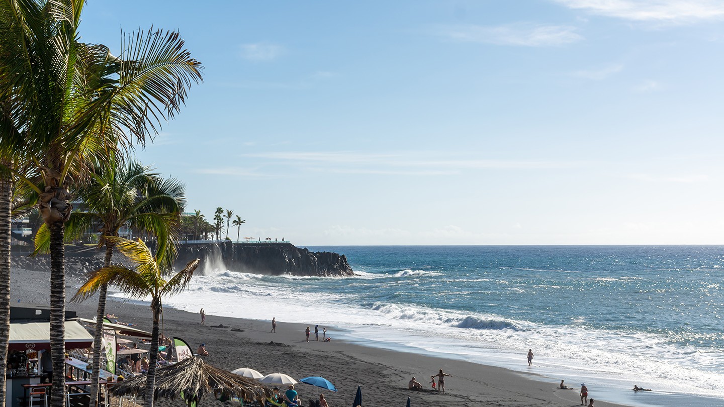
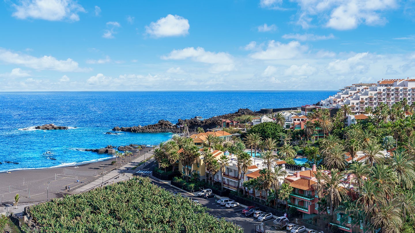
Puerto Naos
Puerto Naos, in the south-west of La Palma, stretches along the island's longest beach. As a result of volcanic eruptions in the past, the beach is black with ash, and the contrast against the deep blue of the Atlantic is striking! It's the perfect place to admire some magnificent sunsets. Distance from the airport: 33 km.
Tazacorte
Tazacorte stands out from the crowd for its charming historic centre and its banana museum, the only one of its kind in Europe. In the past, the village was mainly used by the Spanish conquerors to grow sugar cane. Today, it boasts numerous banana plantations, as well as a fishing port and marina. Distance from the airport: 32 km.
Our suggestions
To do
- Attention sun seekers! The beach in the port of Tazacorte area holds the record for the most hours of sunshine in La Palma.
- Hiking in the Caldera de Taburiente National Park is an absolute must when staying on the island. This walk gives you a close-up view of the incredible crater, which is 9 kilometres wide and 2 kilometres deep, as well as a beautiful reddish-coloured waterfall in the Las Angustias ravine.
- The laurel forests of Los Tilos and La Galga, with their endless trees, giant ferns and canyons, are other unmissable places for walks in nature.
- La Palma is also a popular diving spot. Its waters are rich with caves and submerged arches where you can get up close to all types of wildlife, including puffer fish, barracudas and multi-coloured neon fish.
To see
- The Roque de los Muchachos, the highest point on the island, is topped by the largest astronomical observatory in the northern hemisphere. It's an incredible spot for stargazing!
- On a boat excursion, you can combine dolphin and whale watching with a visit to the pirate bay of Prois de Candelaria. On this steep coastline to the west of La Palma, there is a gigantic cave that you must see for yourself.
- To the north and north-west of La Palma, near Santo Domingo de Garafia in particular, you will find huge dragon tree plantations, a typical tree of the Canary Islands.
- The island's capital, Santa Cruz de La Palma, is well worth a visit. Stroll through the town to see the historic centre and traditional colonial houses.


Excursions
Excursions allow you to discover your destination from all perspectives. LuxairTours offers a range of selected tours that will help you to discover unmissable places, paradisiacal beaches, typical dishes... LuxairTours organises a range of quality excursions for you :
-
This hike will show you that La Palma is so much more than just its volcano. The moment you enter the laurel forest of Cubo de la Galga, you'll see why La Palma is also known as the greenest island of the Canaries. Throughout the 7 kilometre hike, you'll be immersed in lush natural surroundings where calmness is everywhere you look. The walk takes you through the forest to the Mirador de Somada Alta, a viewpoint from which, on a clear day, you can see the islands of Tenerife and La Gomera. You'll then continue on to Salto del Enamorado, another viewpoint offering unrivalled panoramic views of the agricultural slopes of La Palma and ideal conditions for stargazing as soon as night falls. To get there, you'll also pass the Mirador de San Bartolomé, the ravines of Nogales and La Galga and the Mirador de La Montaña.
Hiking route: 7 kilometre loop, gradient: +300 m. / -300 m., duration: approx. 4 hours.
Practical tips: Wear suitable clothing and walking shoes, bring warm clothing and sun protection, and plenty of food and drink (meals not included).
-
The eruption of Cumbre Vieja on 19 September 2021 had a profound effect on the island of La Palma. This activity will help you to learn more about the eruption of this volcano and the impact its activity had on the landscape. From the viewpoint of La Plaza de Tajuyia, you can get as close as possible to the lava flows and see the new lava belts that have even changed the topography of the coast at El Puerto de Tazacorte. You'll then set off on a 2.5-hour hike through the Llano del Jable with an experienced guide, approaching the area closest to the Cumbre Vieja cone along a new path created specifically for this purpose. During this leisurely hike, you'll learn about the different measuring tools used today to study this phenomenon and be amazed at the resilience of the Canary pine, which has survived natural disasters once again and transformed the Aridane Valley.
Itinerary by bus:
Departure from Fuencaliente around 9:00, Cancajos around 10:00 and Santa Cruz de la Palma around 10:20.
Return to Cancajos and Santa Cruz de la Palma around 17:45 and to Fuencaliente around 18:45.Departure days: Mondays, Tuesdays, Wednesdays, Thursdays, Fridays and Sundays.
Services included: Guided bus tour, guided walk of around 3 hours (5.5 kilometre round trip)
Recommendations and practical information: Be in good physical condition, have no respiratory problems, wear footwear suitable for rocky terrain, comfortable clothing and bring plenty of food and drink (meals not included).
-
This hike along the PR LP13 trail will take you to the heart of the Caldera de Taburiente National Park, allowing you to feel the heartbeat of the island. This ancient crater, 8 kilometre in diameter and up to 2,000 metres deep, is an incredible geological attraction. Thanks to its fertile soil, the vegetation is particularly abundant and the fauna omnipresent. Starting out from the Mirador de Los Brecitos, at an altitude of 1040 metres, you will travel through the wilderness down to the heart of the national park, passing by unspoilt landscapes of gorges, streams and waterfalls. You'll cross some of them over small wooden bridges and have the chance to bathe in the clear waters of the Taburiente before a demanding ascent to the majestic Roque Idafe, a sacred symbol for the island's inhabitants. You'll then make your way through the Barranco de Taburiente ravine to the iconic Cascada de Colores, with its ochre, reddish and green tones giving the place an enchanting feel. You will then take the exit from the Barranco de Las Angustias to get back to the starting point, where you will be able to look at the unique rock formations.
Hiking route: 16 kilometre loop (departure and return from the Los Brecitos viewpoint), altitude difference: +100 m. / -700 m, duration: approx. 6 hours. Itinerary may vary according to weather conditions and the recommendations of the relevant authorities.
-
At an altitude of 2,456 metres, the Roque de Los Muchachos is the highest point in La Palma, offering breathtaking views of the ocean's horizon and an unforgettable sea of clouds. It is also one of the most popular places in the world for astronomical observation, which is why there are so many telescopes here. The proposed hike starts at the Roque de Los Muchachos viewpoint and takes you along the GR 131, also known as "El Bastón", along the ridge of La Caldera de Taburiente National Park. Initially quite steep, the slope becomes gentler as you pass the scientific installations, and throughout the hike you'll be amazed by the beauty of the panorama over La Caldera. On the way to the summit, you'll come across a variety of vegetation including cedars, broom, pansies and tajinastes, whose spring flowering adds an extra attraction for those doing the hike in spring. You will also cross a basalt stone wall known as Roberto's Wall, which is the subject of a unique legend, and continue on to the Mirador de Los Andenes, a viewpoint from which you can see almost the entire course of the Barranco de Las Angustias ravine. From here, the path continues to wind its way between various obstacles shaped by the mountainous terrain as far as the Pico de La Cruz, where, on a clear day, you can see El Hierro, La Gomera and Tenerife.
Hiking route: 7 kilometre loop, gradient: + 150 m. / - 200 m., duration: approx. 4 hours.
Departure dates: Wednesdays and Sundays
Practical tips: Wear suitable clothing and walking shoes, bring warm clothing and sun protection, and plenty of food and drink (meals not included).
-
This walk to the north-west of La Palma will take you to the Porís de Candelaria, often referred to as the Bay of Pirates. Hidden beneath a gigantic rocky promontory, this is one of the most unique and authentic spots on the island. To get there, a hiking route will take you from the Barranco del Jurado ravine, which separates the village of Tijarafe from the district of El Jesús. From here, you will take the PR LP 12.2 trail towards the ocean, winding your way between immense rock faces that can reach an altitude of 620 metres. This canyon is of particular geological interest and is home to an amazing bird and plant population, making it a protected area. The canyon narrows as you descend towards the beach of Jurado, where the village once served as a port where goods - salt and fish in particular - entered and left the region. You will then climb back up the right bank of the El Jurado ravine along a winding path similar to the one you took on the way down, enjoying magnificent views along the way. In less than half an hour, you'll get to a natural harbour built in honour of the Virgin of Candelaria, which you can visit at your own pace before catching the shuttle bus back.
Hiking route: 7 kilometres one-way, altitude difference: + 50 m / - 700 m, duration: approx. 5 hours.
Practical tips: Wear suitable clothing and walking shoes, bring warm clothing, a swimming costume and sun protection, as well as plenty of food and drink (meals not included).
-
With their cloudless skies and lack of light pollution, the Canary Islands have the perfect conditions for stargazing. In La Palma, one of the world's most prestigious astrophysical observatories is located at the Roque de los Muchachos lookout point, at an altitude of 2,426 metres. The proposed route will allow you to admire the beauty of the skies over La Palma and learn more about the unique features of this observatory and the telescopes installed on either side of the route. On arrival at the summit, watch the sun set over a glass of wine until the stars come out. You can then observe the sky through a telescope and a team of Starlight specialist guides will show you an infinite number of stars, galaxies, planets and nebulae.
Itinerary by bus:
Departure from Fuencaliente at around 14:30 and departure from Cancajos at around 15:30
Return to Cancajos around 22:30
Return to Fuencaliente around 23:15
These times may vary depending on the pick-up point and nightfall.Duration: 5.5 hours
Departure days: Mondays, Wednesdays and Fridays
Services included: Guided bus tour and astronomical observation.
-
La Palma is renowned for its lush natural heritage that is well worth exploring. This bus excursion will allow you to admire all the wonders of the island, from verdant canyons and dizzying peaks to vast forests and small, unspoilt villages. The journey will take you first to the Mirador Montaña de La Breña and the Salto del Enamorado, where the view of the steep coastline is spectacular. After a coffee break at the chapel of San Bartolo, which is very close to this viewpoint, you will continue on towards San Andrés y Sauces, home to the magnificent Los Tilos nature reserve, a UNESCO World Heritage Site which is often described as La Palma's green lung. As you continue towards the coast, you will also stop off at San Andrés – one of the most enchanting spots on the island, surrounded by banana plantations and with its own ancient church. Later, on a stroll to Puerto Espindola, you can see the natural pools of Charco Azul and visit the Ron Aldea distillery. The tour ends with a stop in the historic centre of Santa Cruz de La Palma to see the capital's most iconic landmarks.
-
This 17-kilometre hike will take you on a voyage of discovery of the island's most active and most ancient volcanoes, which have unforgettable views of both sides. Departing from the Pilar refuge at an altitude of 1,450 metres, you will begin with an ascent and then walk along the volcanoes of San Juan, Las Deseadas (the highest point on the route at 2,000 metres), El Cabrito and finally the Martín volcano, whose eruption in 1646 created a crater of reddish, ochre and black that contrasts with the green of the pine forest. You will then continue on to Fuencaliente, where the tour ends.
Itinerary by bus:
Departure from Fuencaliente at around 7:45, from Santa Cruz de La Palma at around 8:30 and from Cancajos at around 8:50.
Return to Fuencaliente at 17:30 and return to Cancajos and Santa Cruz de La Palma at 18:00.Hiking route: 17 kilometre round trip, altitude difference: + 650 m. / - 1400 m, duration: approx. 7 hours
Departure days: Thursdays and Saturdays
Practical tips: Wear suitable clothing and walking shoes, bring warm clothing and sun protection, and plenty of food and drink (meals not included).
-
After departing from the Cancajos region, you will follow the south-east coast to the Fuencaliente salt flats, passing between the San Antonio and Teneguín volcanoes and crossing the lava flows of the new Tajogaite volcano. After a visit to the salt flats and a lunch break, you wil then continue to the La Cumbrecita visitor centre, where the views of La Caldera National Park are astonishing. You will then head for Llano del Jable, a viewpoint from which you can see the new Tajogaite volcano. On the way back to your hotel, there will be a final stop at Llano de la Ventas, on the east coast of the island.
Itinerary by bus:
Departure from Santa Cruz de La Palma at around 8:30, with pick-ups at Cancajos at around 8:40 and Fuencaliente at around 9:00.
Return to Cancajos and Santa Cruz de La Palma around 17:15.
These times may vary depending on the pick-up point.Departure days: Tuesday
Services included: Guided bus tour with various stops to discover and explore the landscape.
Practical tips: Bring snacks and drinks (lunch not included), wear closed-toe shoes and appropriate clothing.
For more information and bookings, please contact your LuxairTours guide on site.
Important information
The beaches of the above-mentioned tourist locations have sun loungers and umbrellas available for hire by external providers.


